|
|

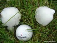
Perhaps the most interesting and unusual aspect of CoCoRaHS is hail mapping and analysis. One of the prime motivations for collecting hail data is to gather better information on the frequency, timing, and characteristics of hail storms and the hailstones that accompany them. Our knowledge of hail is limited because it tends to occur over small areas for short periods of time. Even in hail prone areas like Colorado, hail doesn't tend to re-visit the same spot very often.
Because CoCoRaHS hail reports are sent directly to the National Weather Service (NWS), our observations also help NWS forecasters track storms and have, on more than one occasion, provided guidance for issuing severe thunderstorm warnings.
Information and Links About Hail:
How CoCoRaHS Collects Hail Data
Colorado Hail Fact Sheet
Cool Graphs and Figures About Hail Frequency, Distribution, and Damage Across the U.S.
Summary and Statistics About Hail in Eastern Colorado(4.0 MB PDF)
Origins of Hail
Observing Hail with Weather Radar
Overview of the National Hail Research Experiement (NHRE)
|
|